All Posts By

admin

Mount Silverheels 13,822′ – Trip Report

By Uncategorized

Downloads: GPX File | KMZ File for Google Earth

Mystic looks east from the summit of 13,822' Mount Silverheels.

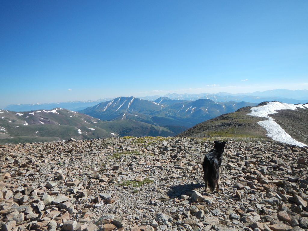
Mystic looks east from the summit of 13,822′ Mount Silverheels.

Mount Silverheels checks in as Colorado’s 96th tallest ranked summit. At 13,822’, it’s technically a Front Range mountain, but as a hike, it’s more like a classic Sawatch Range Peak: long, gentle, slopes that top out on a rounded summit with spectacular views. Silverheels is somewhat tucked away, despite its hulking presence from popular vantages points such as Boreas Pass. As a result, there are no established hiking trails to the top.

What it lacks in popularity it makes up for in legend. The memorable moniker is named after a popular dance hall girl who wore the apocryphal silver heels—geographic features named after women of both favorable and ill repute is common in Colorado. As the legend goes, this mysterious woman had a heart as big as her… heels. While others fled the area during outbreaks of sickness, she stayed to comfort the remaining miners. Silverheels herself was said to have come down with a case of smallpox that permanently scarred her face, so she resorted to wearing a blue and white mask that further obscured her true identity. Eventually, both Silverheels and the town she inhabited, Buckskin Joe, disappeared into Colorado lore. Whether or not Silverheels actually existed remains up to debate, but the mountain named in her honor is very real.

A simple map of Mount Silverheels easiest line from Forest Service Road 659.

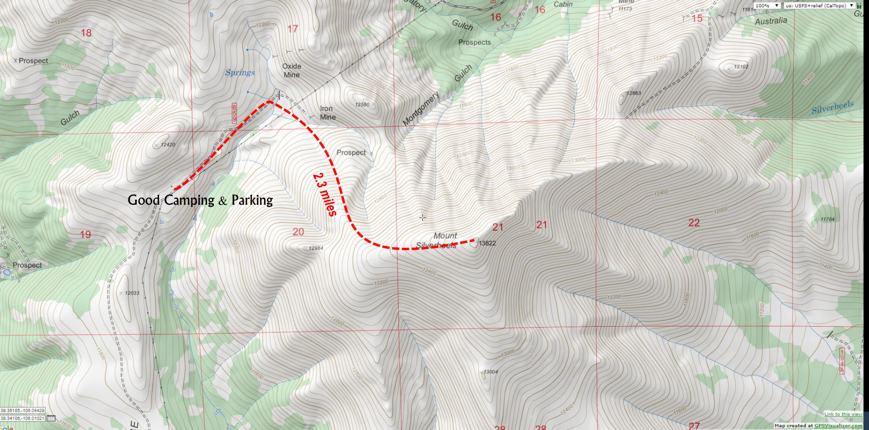
A simple map of Mount Silverheels’ easiest line from Forest Service Road 659. Click for larger map.

Most people access Silverheels from Hoosier Pass, mostly because of the ease of parking. We opted to hike the mountain from the less popular West Side via Forest Service Road 659. My main motivation in choosing the less-traveled route was to explore the low-traffic basin and mining ruins in the area. A surprisingly well-maintained 4×4 road climbs just over 12,000’. A series of space-age looking power towers stand in line in the open mountain tundra. These massive metallic sentries add a surreal element to the otherwise pristine backcountry. In fitting fashion, the towers’ silver-white skin gleams under Rocky Mountain sunshine. My guess is that whatever enterprise maintains these towers is responsible for the upkeep of the road. (For directions and driving info, read the directions at the end of this post).

Forest Road 659 was better maintained than the access road to reach it, Beaver Creek Road. Beaver Creek Road wasn’t anything crazy, but it is riddled with tooth-jarring washboard ruts. After passing a cattle gate (which serves as a winter closure), the road ascended from about 10,000’ through dense willow thickets before climbing up a scrappy-but-not-technical hill to 11,800’. I almost had to put my 4Runner into 4-Low here. This hill is the most challenging part of the drive up. Stock SUVs and even vehicles like Rav4s and CRVs can make it up this road—I’d even say that a very carefully driven car could make it up, though I’ve knocked enough exhaust parts off my old beater Honda Accord to know better.

Oh, as a sidenote: on many maps, there is mention of a Beaver Creek Campground. I asked the South Fork Ranger district about this location and as I suspected, it’s an old, dispersed camping spot, not a formal campground. There are lots of decent camping spots along the six mile stretch from the cattle gate and it’s almost guaranteed you’ll be able to find a good one—just make sure to pay attention to specific closure markers in certain spots.

Mount Silverheels Camp

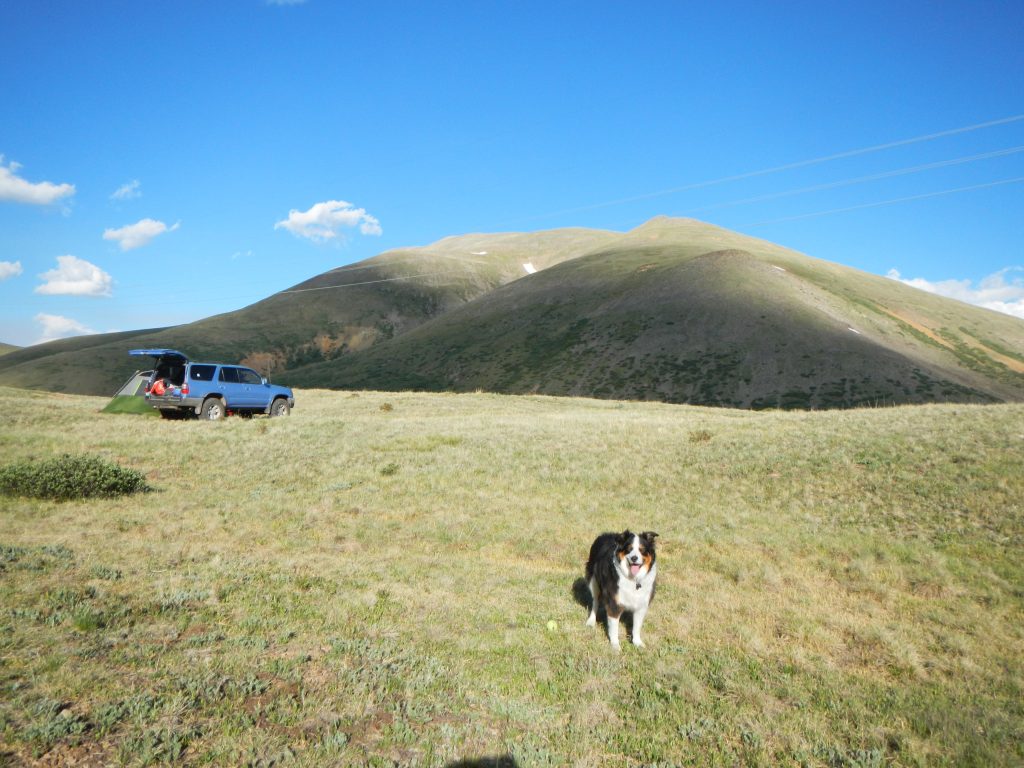
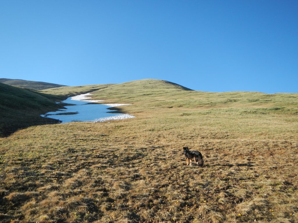
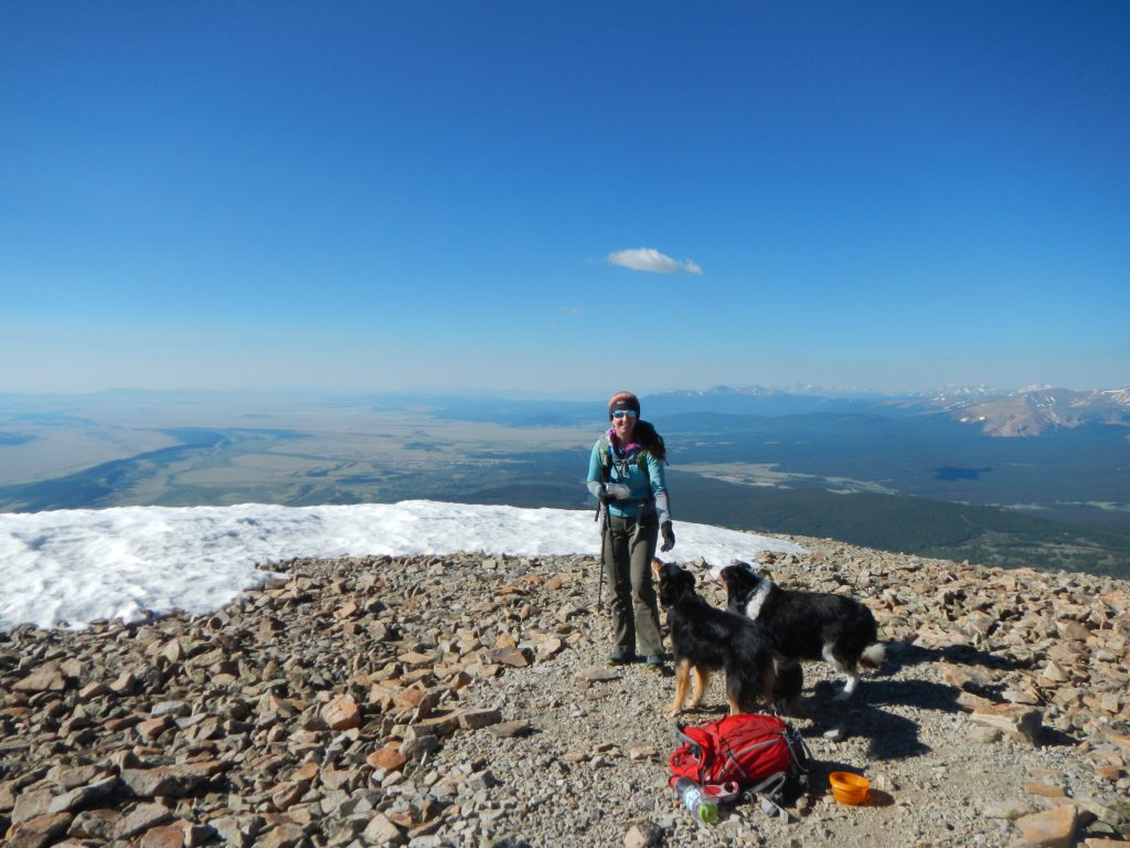
Fremont at our camp at 12,040′. The summit of Mount Silverheels is the highest point on the high background mountain. It’s 2.3 miles one-way to the top.

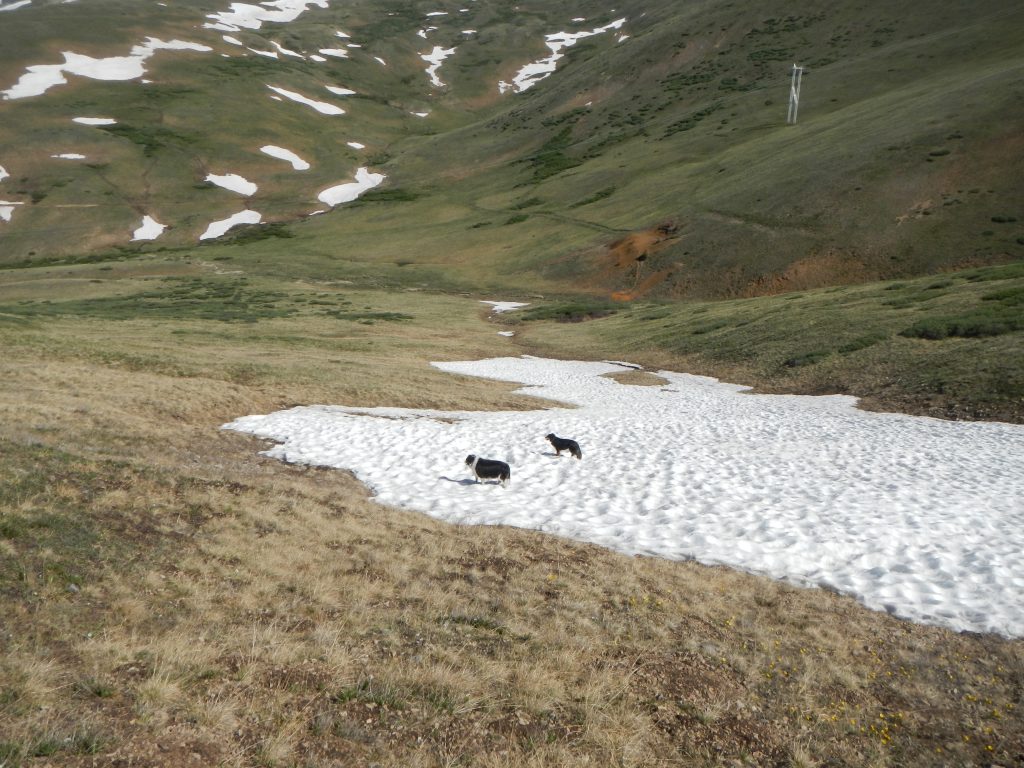
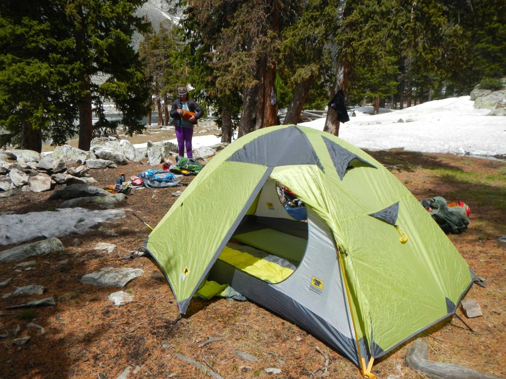
At 11,800’ a wide-open vista offers spectacular views of the Tenmile Range to the west and presents a good place to car camp. Note that I literally mean “car camp”. The winds are mighty strong across this ridge. In retrospect, we should have pulled off a short ways down the spur road (441) to the left of 659 and set up camp in a tree-protected area. We continued on a bit farther to another flat, open area that was at the foot of an unnamed 12,420’ hill and set up camp here. We set up our not-all-that-weather worthy car camping tent here (6-person, lots of room for two people and two pups). Despite moving our truck to divert some of the gusts, it was a lousy night of sleep as the tent walls snapped and pulsed in the non-rhythmic wind. Thus, actual car camping in your vehicle might be a good idea. Also, trying to sleep at 12,000’ when coming from 5,400’ in Boulder can be difficult, so a lower campsite may be a wise choice.  

The road beyond this only goes about 0.4 miles to a closure point and in my opinion, isn’t really worth driving. Parking at the flat section roughly 6 miles from the cattle gate was perfect—the walk down to the end of the road only took about 10 minutes on nearly flat roads. The shelf road had suspect durability on the downhill side and my suspicions were confirmed where we saw a hapless Jeep stranded in a perilous rut where a small drainage crossed the road. If you do choose to drive, there are only a few small pull-offs and a tight, but usable, turnaround at the road closure.

Oh crap. Jeep is in a pickle!

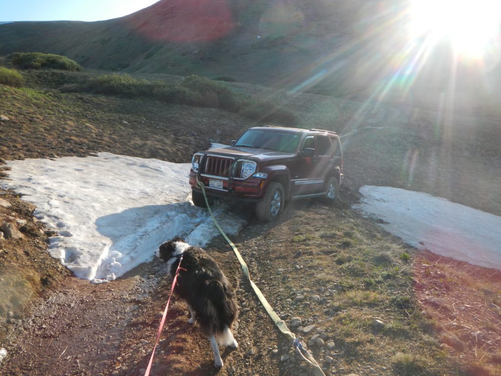
Yolks! This poor Jeep was in a precarious position!

Enough, Man! What About the Hike!?

Right.

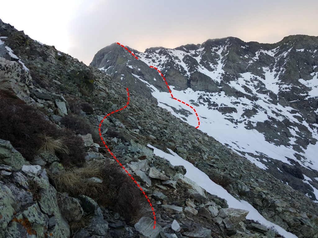
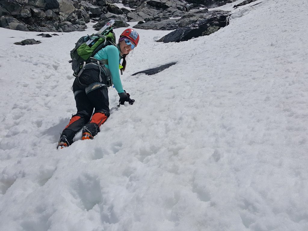
So starting from our camp, we walked 0.4 miles to the road closure, where an easy step-over stream crossing led us to wide-open slopes. A site labeled on most maps as “Iron Mine” is at the end of the road beyond the closure and could be accessed to pass the creek if needed. After that, it was hill-walking at its best. There are no trails, but we followed the path of least resistance, taking the northwest slopes to eventually connect to the west ridge. It’s steep, with about 2,000 vertical feet of elevation gain, but the footing is on solid, grassy terrain. This is a preferable option than the West Ridge Direct route, since that path involves cruising through willows and rockier, less-stable footing.

Mount Silverheels Approach

The lower part of the slopes on Mount Silverheels.

Mount Silverheels Slopes

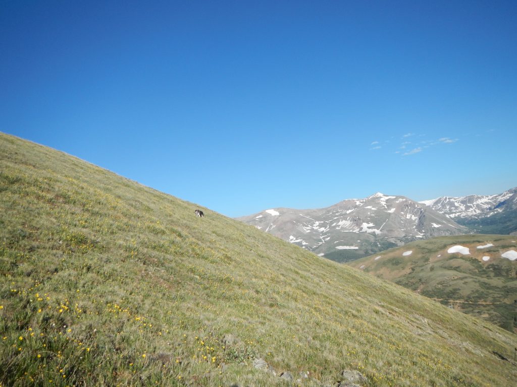
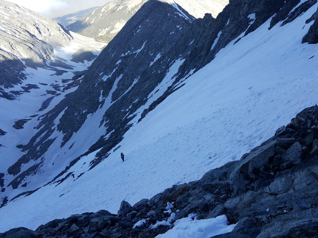
Fremont shows off on the northwest slopes that connect to the west ridge.

Bumbles bounce!

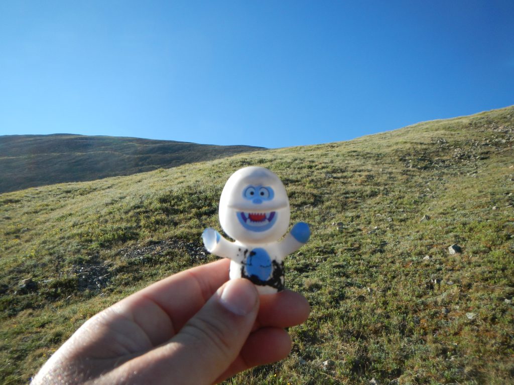
Aha! I found a cheerful Bumble hidden in the grass!

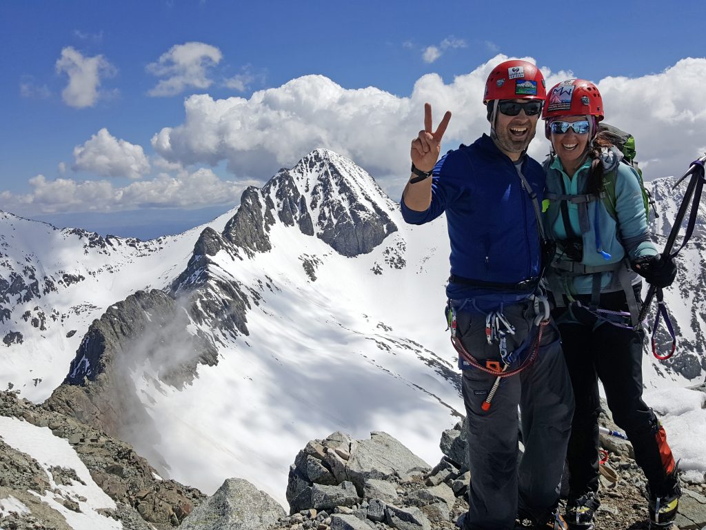
After gaining the broad west ridge at 13,300’, we had a pleasant ridge walk over to the summit. It was 2.3 miles from our camp to the flat summit, where a wind shelter was a welcome sight. A pair of 13ers, Boreas Mountain and Bald Mountain, loom to the east. 13,352’ Hoosier Ridge (the summit name of the highpoint of the ridge) and Red Peak C were to the north, and the full majesty of the Tenmile Range and distant Sawatch Peaks dominated the west, including the curving ramp of 14,265’ Quandary Peak. West looked down on a flat, peaceful valley and the tiny town of Jefferson.

Silverheels Summit Approach

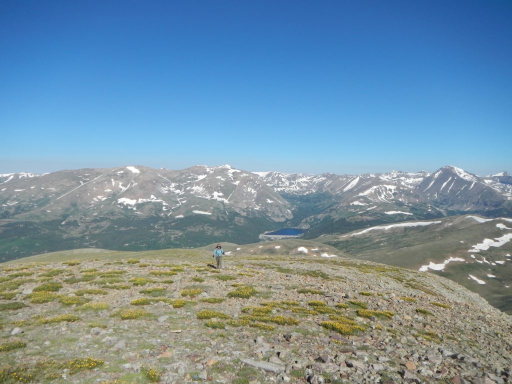
Sheila approaches the summit.

Mount Silverheels Summit

Forget the views, we want a treat, woman!

Mount Silverheels summit

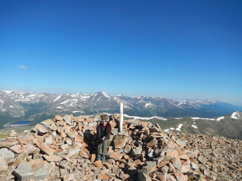
The summit wind shelter on Mount Silverheels.

Silverheels summit

Hanging with Mystic on the summit!

The flowery summit ridge of Mount Silverheels.

The flowery summit ridge of Mount Silverheels.

The views to the south of South Park aren't too shabby either. Good boy, Fremont!

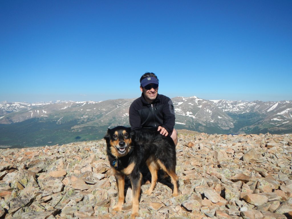
The views to the south of South Park aren’t too shabby either. Good boy, Fremont!

We returned the way we came, though it wouldn’t be out of the question to muscle over to Hoosier Ridge for a bigger day. As it was, the 4.6-mile out and back was a great outing for our dogs and made for a great half-day hike (3.5 – 4 hours at a modest pace).

Truth be told, we were both weary from the non-stop wind the night before so a shorter day was perfect. We saw a pair of hikers on the summit who took the “standard” Hoosier Pass route, which works just as well. It’s an 8-mile out and back and the parking is much easier to access (off the top of the paved Hoosier Pass). That said, I found the remote feeling of FS 659 to be a unique Colorado environment, almost like something out of an apocalyptic movie. There was little human presence, but the decent road and airy metal towers created an atmosphere of a futuristic ghost town. If ever there was a hike that wagered its reputation on ambiance, this is it.

Silverheels snowfield

Cooling the paws on the 4th of July!

Who knows, maybe the spirit of Silverheels herself floats in the air in this scenic and inviting Centennial Peak.

silverheels end of 659

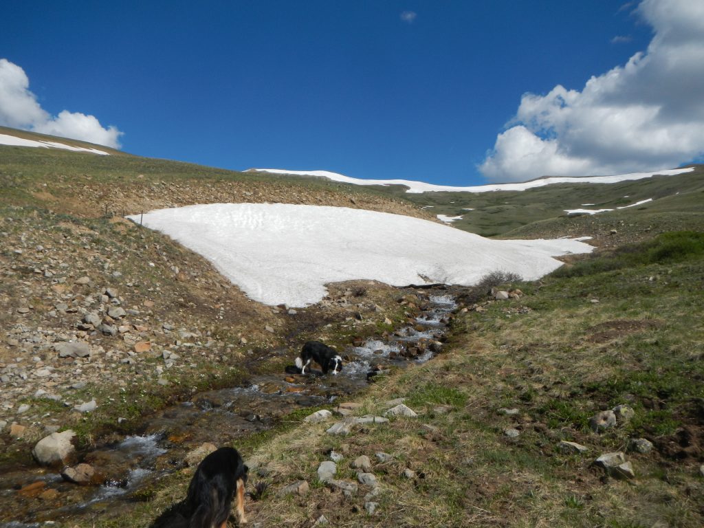
One last drink before the ride home.

Driving Directions

Note: Google Maps is really screwy about the road numbers here (as of July 2017). It shows FS 655 when the road is actually marked as FS 659. I preferred to use CalTopo maps from GPSVisualizer.com to figure out the way to go. Google Maps seems to mislabel forest road numbers. Rest assured, this is an easy route to find once you’re actually there.

Take either Hwy 285 or CO 9 to the quirky town of Fairplay. Off CO 9, turn onto 4th Street. Turn left onto Beaver Lane (which has signs saying “National Forest Access”) and follow this level but heavily washboarded road about 2.9 miles to a right turn (where is another forest access sign here). Note that somewhere along the way, Beaver Lane turns into Beaver Creek Road—it’s the same road.

After turning right, continue a few hundred feet to the winter trailhead and a cattle gate. This is FS 659. Open the gate, pass through, and please close the gate before continuing here. The 4×4 road gets nicer here (oddly) and continues for 6.5 miles to the road closure. There is good camping all the way up to mile 6.0, but I’d suggest the sheltered spots off the left of FS 441 (marked). They are only a few hundred feet down the road. The only tough part of the road is the aforementioned hill, a bouncy but non-technical steep climb that I barely pushed up in normal 4×4.

Park in the open meadows at 6 miles in (near the power towers). Just after this, the road becomes a true shelf road with sketchy turnarounds. That being said it’s the same mellow grade and sparsely rocky surface as the rest of the road.

The post Mount Silverheels 13,822′ – Trip Report appeared first on Mountain Air.

Powered by WPeMatico

Little Bear Peak – Trip Report – Colorado 14ers

By Uncategorized

Ah, Little Bear Peak, so we meet again.

This 14,037’ summit in the Sangre de Cristo Range has a well-earned reputation as having the most difficult standard route out of all of the 58 recognized 14ers in Colorado. As a fellow climber remarked on her way off the mountain, “It’s a beast!”.  

This is true. Little Bear is a beast.

Little Bear Peak summit traverse

The last, short traverse to the summit of Little Bear—a lot of hard work to get to this point!

Climbers have two options for reaching the summit. A summer climb involves class 4 scrambling on very loose and unreliable rock, especially by the standard Southwest Face / West Ridge route. The notorious Hourglass Couloir is a funnel for stones accidentally kicked down and has been the site of many accidents and close calls. Add to that, the Hourglass proper is often streaked by a cascade of water that can freeze over any month of the year.

The second option is waiting for snow to blanket the mountain. In early winter, avalanche potential tends to stay high. The danger in the Hourglass is neutered but not entirely absent, though the exits from the couloir require gutsy moves on 60-degree pitched snowfields (that tend to turn to mush in the afternoon sun).

Between these two worlds is a Goldilocks zone: stable, consistent snow in the couloirs, little snow on the traverses, low storm potential, and enough daylight to get it done. My first ascent of the peak back in 2003 was as a summer outing and it was fairly miserable—no snow, lots of people, tons of kicked rocks, and tricky route finding. I made to the top in good time, but vowed I wouldn’t do Little Bear in those conditions again. It simply wasn’t all that fun.

So, as my wife Sheila is closing in on wrapping up the 14ers, I figured it would be fair to pay LB another visit with her. My only condition—we do it when there is good snow on the peak. We actually aimed to get the peak in 2015 but got rained out by a storm that moved in a day early. This year, we were lucky: perfect weather, conditions as good as they can get, and a free weekend. A minor downside is that we were pretty much doing the climb off the couch.

The Approach

A chilly river crossing along the Lake Como 4x4 road.

A chilly river crossing along the Lake Como 4×4 road.

The standard route up the peak doesn’t make anything easy. Most people do the adventure as an overnight, camping at 11,700’ Lake Como. There is a 7-mile 4×4 road to deal with first. The lower 2.5 miles of the road is a ribbon of rounded, jarring stones—bad news for anyone driving low-clearance cars. SUVs can rattled their way up roughly 5.5 miles, depending on how badly they want to beat up their vehicles. Beyond that, a series of tricky road obstacles known as the “Jaws” features limit vehicular travel to dedicated 4×4 Jeeps and rock crawlers. Most climbers have to backpack in at least a few miles before the hike even begins. And, of course, the hike back down after the climb is required.

Lake Como Colorado camping

Shoulder season camping at Lake Como can be on snow or dirt. Or both.

The Climb

On paper, the standard route has benign stats: 2,300’ of vertical in 3.5 miles as an out-and-back. And yet, giving this climb 8 – 10 hours isn’t unreasonable. We started at 3am even though we had a perfect forecast—remember, we’re coming off the couch, here! The route began with a bushwhack through a short section of forest around the lake. Post-holing ensued for about 20 minutes until we got above the foliage, and began the “warm-up”, a 600-vertical foot couloir that cracks the west ridge. Snow conditions were perfect and we were able to kick steps in the darkness.

Little Bear Peak first gully and traverse.

Atop the first gully about to begin the traverse to the Hourglass Couloir.

At the top notch, we removed our crampons and switched out our ice axes for hiking poles to traverse a mile or so of broken but reasonably solid class 2+ rock. The trail here is semi-marked by cairns and skirts below the west ridge. Eventually, the traverse hits a pair of snowfields that ascend on 25-degree slopes to the base the Hourglass Couloir at 13,300’.

Little Bear traverse to hourglass.

A look at the route from the mid-traverse to the Hourglass. The line disappears where the path dips behind rock.

Hourglass traverse little bear peak

The second part of the traverse to the base of the Hourglass is surprisingly steep. On good snow, it’s a relatively easy trek.

The Hourglass and Beyond

The snow was fantastic in the Hourglass. It was consolidated, thick enough to sink crampons and ice axes, and fully in. The actual Hourglass proper is rather tame—150-feet up to a heart-shaped, ice-slicked, boulder that serves as an anchor for summer routes. An old, blue rope slipped out of the snow and over the stone like a varicose vein. At this anchor, climbers have to make a critical choice: exit left for the steep but more direct way to the top, or skirt right for a longer, more sustained snow climb on modest 35-40 degree slopes. We opted to go left.

Hourglass Couloir Little Bear Peak.

Sheila in the Hourglass, below the telltale anchor. This is on the descent, you can see our tracks headed up and left.


In my opinion, this left exit is the crux of the route. The snow ribbon terminates at a craggy wall, where exiting means a tricky, no-fall-zone class 4 scramble through a 12-foot section of rock that was iced over in places. A better exit is about 50 feet below this, where crossing over a few rocky patches leads to the 60-degree snow slope that eventually twists up to the top (bear right, crossing a stone spine in the ridge to the final snowfield).

Either way leads to a snowfield that trends up to a stubby spine of rock that separates this portion from the final summit snowfield. Heading climbers right, we scampered over rock, snow, then rock again before breaching the final 100 feet of snow. Blue sky and blazing white snow are all the eye can see until reaching the highpoint on the ridge. Mercifully, the summit is only about 80 feet from the top-out point. It’s a flat, welcoming place with utterly spectacular views of 14,345’ Blanca Peak to the north and the sun-baked farms in the flat lands below.

The return down starts off easily enough. Retracing the snowfield and rock crossings and snow patches was quick going. It wasn’t until we reached the aforementioned crux section that stood between the Hourglass proper and the upper mountain that we really had to have our A-game on. The downclimb on 60-degree snow for a good 200 feet or so is relatively easy if snow conditions are good (as they were for us). It’s worth noting that we did bring an alpine rope (30m, 9.1mm dry rope), ice pickets, and harnesses for the day, though we never used them. This section is the reason why: if it had been melted out, ice-hard, or unconsolidated, protection is a wise idea. But, we just moved vigilantly down the snow, across a rock band, and slowly back to the Hourglass anchor, where the angle eases up. The first 70’ of the Hourglass we descending face in, but the last 75’ or so we could plunge step face-out.

The Final Steps to the Finish

Little Bear Peak summit - wooo hoo!

The coveted summit of Little Bear Peak with Blanca Peak in the background.

We scampered across the snow slopes, back to the dry traverse, where we once again removed our crampons and stashed our ice axes. After an uneventful crossing, we were back at the notch. If the conditions are soft and you are a confident glissader, this can be a zippy descent. As it was, conditions were soft enough to face-out plunge step most of the route. A 70’ section near a narrow choke in the middle of the route was a bit thin, so we opted to turn face-in for a few steps, before glissading down the lower quarter of the gully. One more post-hole-ridden traverse through the woods and we were back at camp, having tagged the top of Little Bear and happy for a brief rest—we still had a 4-mile backpack down to our 4Runner, parked 3 miles up the Lake Como road.

Thoughts and Observations

While we could have used a bit more training before heading up, we had a solid-but-long day. Fit, confident, climbers can knock this one out in 5 – 7 hours (in snow conditions) but I’d give 7 – 10 hours if you’re moving more cautiously or want to set up anchors. If you’re hoping to knock this one out from a camp on the road, hopefully you’ll have a 4×4 that can get up between 5 to 5.5 miles to reduce the tedium of a long day hike.

It’s worth noting the really bouncy rocks last for about 3 miles—the road actually improves from about mile 3.5 until the first SUV-blocking obstacle about 5.5 miles up.

The post Little Bear Peak – Trip Report – Colorado 14ers appeared first on Mountain Air.

Powered by WPeMatico

Caffeine Detox: It’s Gonna Hurt

By Uncategorized

Caffeine withdrawal is a real thing. If you don’t believe me, try drinking 2 – 5 cans of Monster Energy drink for 6 months then shutting off the switch. Better yet, let me tell you my experience and save you the trouble. I was ingesting about 400 – 500 mg of caffeine per day, mainly because I wanted to stay sharp in my work as an editor and writer. I also used caffeine to summon energy during one of life’s inevitable rough patches, including the loss of a beloved pet, minor but nagging injuries, and to be honest, general anxiety over the mess that is current American politics.

The short-term strategy of upping my caffeine intake worked. I didn’t miss any deadlines, the injuries healed, and I haven’t given up my citizenship and gone off to live in a commune in Greenland. The downside is that caffeine isn’t an easy habit to jettison. Caffeine is ridiculously effective at reversing the immediate effects of withdrawal (which can kick in as little as 24 hours after your last drink). Aches and lethargy vanish in a flash with one sip, as any coffee enthusiast on a Monday morning can attest to. The poison happens to be a wonderful cure.

caffeine-1The weird thing about caffeine is that it is not a universal bad guy. In moderation, it has benefits that include increased energy, increased focus, and a low-level sensation of pleasure. Caffeine works by binding to adenosine receptors in the brain. Adenosine is a molecule that basically tells the body it’s time to rest. When adenosine is blocked, the body still gets tired but it doesn’t get the message to do anything about it (thus the infamous caffeine crash when the effects wear off). Caffeine’s two-pronged feel-good attack also modestly elevates dopamine levels, which can help improve mood and overall mental agility—caffeine is officially classified as a psychoactive drug.

Caffeine’s downsides do have some extreme, though rare, consequences. Certain people are prone to caffeine intoxication and caffeine overdose, which can result in death. Also worth noting: caffeine is toxic for dogs, cats, and most birds. For most people, caffeine’s dark side comes from dependency. Compared to other stimulants, withdrawal effects are mild, but they are disruptive. I realized it was time for me to nix my caffeine intake because I started to get headaches without it. Sleep was becoming unpredictable, my body was getting jittery, and I felt like someone turned the lights out in my brain when the potency of caffeine wore off.

I figured it would be easy enough to just quit cold turkey. After further reading, I realize that’s not necessarily the best approach (a four-week gradual decrease is suggested). I had a few things in my favor. I am not a coffee or tea drinker, which are safer, natural sources of caffeine compared to my beloved energy drinks. So why is this an advantage? I had no ritual around my beverages, so there was no routine to break. Also, I didn’t start using caffeine on a regular basis until my late 30s, so I don’t have a long emotional history with it. I know caffeine is a drug, but given how ubiquitous and benign it is, I figured I’d have a day or two of being cranky before weaning myself away from the daily fix—no big deal.

I was wrong.

caffeine-cat

So How’d It Go?

Caffeine addiction is mercifully “easy” to break, compared to other drugs. Research says it takes 9 – 14 days to revert the chemical dependency, with the worst symptoms happening within the first 24 – 72 hours. How tough can it be? Here’s a bullet list of typical caffeine withdrawal symptoms and my own experiences:

  • Persistent Headache – Yes
    The same day I opted out of caffeine, I began a dull, noticeable headache that lasted four days. Advil (ibuprofen) helped ease this. Because I’ve had migraines in the past, the caffeine headache felt relatively mild. Finally, on the 5th day, it went away on its own. It was never so bad that I couldn’t do my work or drive my truck, but I was definitely aware of it.
  • Fatigue – Yes
    It only took 24 hours before deep fatigue and low motivation came into the picture. Like the headaches, this got better around day 4. Days 2 and 3 were the worst. I had to rally to get the dogs out for a neighborhood walk and felt so bad on the 3rd day I asked my wife to take over the task (I happen to rather enjoy walks with the dogs). I purposefully planned the brunt of the bad effects to happen over a weekend so it wouldn’t effect my work, which ended up being a wise decision. It was difficult motivating myself to play video games or read—I was apathetic even to things I could enjoy while being a lazy slug. The thought of binge-watching anything seemed too exhausting.
  • Irritability – Sort of
    I can be a bit of a cranky introvert by nature, so when I consulted my wife on how I acted, she said I was more “whiny” than irritable.
    Fair enough. I don’t think I was more bothered by things that would otherwise be minor irritations. I may have been more whiny than irritable thanks to the next symptom—poor sleep.
  • Poor Sleep – Big Time Yes
    For the first 3 nights, sleep was awful. Oddly, if I had consumed caffeine before bed during this period, it might have helped me doze off. That seems counterintuitive, but biology explains it. Those aforementioned adenosine receptors were now open for business and without any regular pattern to follow, everything went wonky. The first two nights were bad: restless, interrupted sleep, with lots of wakeful hours. The third night was brutal. Even though I was physically exhausted, sleep wasn’t going to happen. I was absolutely freezing under the covers, which is a 180-degree (not literally) reversal from my “always hot” sleep habits (I consider anything over 65 degrees “Nursing Home Hot” and too warm to get a good night’s sleep).

    Not only could I not sleep, but on the third day my joint and muscle pain was so bad that I thought I was getting sick. More on that below, but the bottom line is I had a solid three nights of little to no sleep. The fourth night I was finally able to get a few 4-hour chunks of sleep and by the fifth night, things seem somewhat normal.
  • Hot / Cold Sensations – Oddy, Yes
    This one surprised me. I’m almost always too hot, a complaint my friends and family know all too well. But for a 24-hour period starting on the third day, I simply couldn’t get my bones warm. Hot showers didn’t do anything, nor did blankets or sweaters. It’s a strange coldness. When it was hot outside, I didn’t feel an outer cold, but rather that deep, penetrating cold that seems to lodge itself in your body after prolonged time out on a snowy day. It wasn’t until the 5th day that I was back to my normal, overheating self.  
  • Constipation / Irritable Bowels – None
    This is sort of a gross humblebrag—I’ve never been constipated. I don’t really know what it feels like, though I am fully aware of the concept. No issues here, though from other reports I’ve read, it can be a real issue for some people. Not me, I’ve got the bowels of a champion.
  • Joint and Muscle Pain – Ye Gods, Yes
    Along with the lack of sleep, this was the worst symptom. I already have creaky ankles, but the radiating ache in my feet, knees, shoulders, wrists, and neck was severe. The last time I can remember my joints being this sore was back in 7th grade when I had mono. My right ankle in particular was on fire, courtesy of an accessory bone that inhibits mobility. In other words, my ankles always sort of hurt, but on the second through fourth days, they were in legit pain. Again, Advil helped a little bit but on that dreaded third night of sleep, the pain kept me up. It took about 6 days for joint pain to ease up, making it my longest lasting symptom.
  • Flu-like symptoms – You Kidding Me? Yes
    The third and fourth days felt like being sick… without being sick. My fatigue was easily broken, meaning I had energy, it was just hidden by the withdrawal. Compare that to actually being sick, wherein if you try to take on some grand feat of physical prowess like getting the mail, you stand a good chance of needing a nap at the mailbox. The aches in my joints felt exactly like flu-ache, though it didn’t get worse if I tried to do things. On the 4th day, I went for a 4-mile run, despite still having some really joint discomfort. My pace was about a minute slower than my normal runs and it did hurt, but once I got going, it was certainly bearable (again, in contrast to being sick, when your body would likely shut down).
  • Lack of Concentration – A Little
    Part of the reason I wanted to get off caffeine is that I was overstimulated. It actually immobilized me a bit, since I was a bit more easily distracted than I normally am. Caffeine was great in the mornings… to combat natural fatigue and caffeine addiction… but I’m writing this on day 6 and my thinking seems sharper. So if anything, I actually improved my overall mental acuity, though we’ll see what happens the next time a deadline is looming at 10 pm.
  • Nausea – No
    I hate being nauseous—who doesn’t?—and I haven’t blown chunks in this century. I was glad I never had any nausea or upset stomach. This seems to be a fringe effect that research says may be more related to a change in diet or overall lifestyle that happens during a caffeine cleanse. It wasn’t a factor for me.
  • Anxiety – No
    As far as I can tell, I wasn’t any more anxious than normal. The caveat being that caffeine can actually cause anxiety in some people, especially those like myself who trend towards over-thinking in general. I was certainly bothered that I couldn’t sleep and the joint pain was bad enough that I began to wonder if I actually was getting sick. Otherwise, nothing to speak of here.

Was it Worth It?

caffeine

I’m now a full week into my caffeine detox and I finally feel normal. Actually, better than normal. I’m not getting walloped with caffeine crashes, I’m sleeping better, I’m waking up better (not feeling instantly fatigued and sore), and my brain fog seems to have lifted. I was genuinely and unpleasantly surprised how bad I felt on the first four days. I think if I had been a little more physically active it would have helped, but I did go for a few hikes, climbed at the local climbing gym, and ran, so I wasn’t a total bum. My muscles and joints are still a little stiff and sore, though I suspect it’s the collective ache of a week of poor sleep versus the amplified soreness during the initial withdrawal. My thinking is clear and I seem to have regained the focus and motivation I had during my caffeine “highs”.

Here’s a bit of advice I’d like to pass along if you think it’s time for a detox.

  • Planning the detox around a weekend was a very good idea. Days 2 and 3 were not fun and I’m sure I was not pleasant to be around. If you can parse off a solid 72 hours to detox, you should. Treat it like any other illness: you’ll need rest, maybe a little help, and good food.
  • While my energy drink intake may seem a bit much, I was getting the same amount of caffeine coffee drinkers get from 4 cups a day. If you’re getting less caffeine (50 – 100mg per day) you may not have any issues and thus, not need a detox. I had to make a change because my body’s systems were being negatively affected. I couldn’t sleep, my focus was off, I was jittery, and the caffeine crashes were getting bad.
  • In retrospect, I should have taken in a lot more water. Again, treating the withdrawal like an actual 3-day illness is a good approach. Lots of (non-caffeinated) fluids will help.
  • I haven’t seen this in any of the research, but given that sugar is an inflammatory agent, my joint pain might have been lessened if I consciously avoid processed sugars during the cleanse. This applies to everyday life as well.
  • If you’re going for a detox, read up and be prepared for a somewhat miserable 3 – 4 days (and longer for some folks). Hang in there. I can attest to the fact that I feel much better a week in than I did even when caffeinated.

The post Caffeine Detox: It’s Gonna Hurt appeared first on Mountain Air.

Powered by WPeMatico

Surviving the Political Wilderness

By Uncategorized

The wilderness is both my sanctuary and my livelihood. The ardent and transparently destructive stance towards public lands by our current president and his administration has been troubling, to say the least. I’ve always been tuned into the political side of environmental issues—a “part time warrior” as crusty ol’ Edward Abbey put it—but the urgency of threats that face our public lands have increased my worry. Part time won’t cut it.

I don’t like politics. I’ve had three or four day spans where I was either out in the aforementioned wilderness or else immersed in work where I’ve tuned out the news for a while and admittedly, that constant, underlying, fatigue and stress was lifted. Ignorance is of course bliss, and the choice to remain oblivious simply isn’t an option. That so many Americans remain mesmerized by 45, despite his blatant dishonesty, greed, ineptitude, and narcissist arrogance is revolting—but that’s a subject for political columnists and psychologists. The fact remains that those who truly care about our nation are distressed at the potentially irreversible losses in scientific knowledge and leadership, public lands, and rational thought as a guiding principle.

I say this because I’ve really wanted to retreat to the wonderful 5 acres of mountain land my wife and I own and just be. I want to spend days hiking with my dogs, building trails, reading by the fire, waking up in the cool air, and maybe once in awhile binge watching Bob’s Burgers (hey, we’re not Luddites, we have Internet). And yet, I know that this is the precise time in history to not drop out. The wave of anti-intellectualism has come ashore, washing away critical thinking, replacing it with the same old stubborn but effective fear tactic of welding ugly ideas into the self identities of far too many citizens. This process is nothing new, but to see in manifest in a time and place where the average person has nearly unlimited access to facts, studies, and scientific truths is worrying. The misplaced pride that our president takes in being (literally) unfit, uninformed, and defiantly close minded has sadly trickled down into legions of individuals, primarily rural white Americans who have a very apocryphal vision of what this country once was.

So with this reality before us, I’ve decided to invoke wilderness strategies to think and act in these strange and troubling times. Much like being lost in the woods, inaction is fatal. One must be cognizant of their resources and harbor a genuine respect for predators. One must remain vigilant, focused, and utilize energy in the wisest way. One must realize the safety in numbers. And most importantly, one must dispatch the narrative of how we got here and train their attention on what can be done to navigate out of danger and into the margins of security.

We are in political survival mode. If ever there was a time to cast aside one’s political allegiances and do some soul-searching on the flawed but (mostly) well-intentioned ideals America was founded upon, this is it. To say we as a nation have lost our way is an understatement. We’ve all been forced to switch on our primitive brains and the choice is ours: do we engage this political predation and fight, or do we flee and buckle under the whims of men whose motivation is the transparent hoarding of wealth, deceiving ourselves that we are somehow part of the tribe that would sooner sacrifice us once they’ve bullied our vote and misled our hearts?

I need a nice walk in the woods to think it over.

The post Surviving the Political Wilderness appeared first on Mountain Air.

Powered by WPeMatico